
Coney Island History: Coney Island Maps
I. Detailed Map of West Brighton with Amusement Parks and Rides (1905)
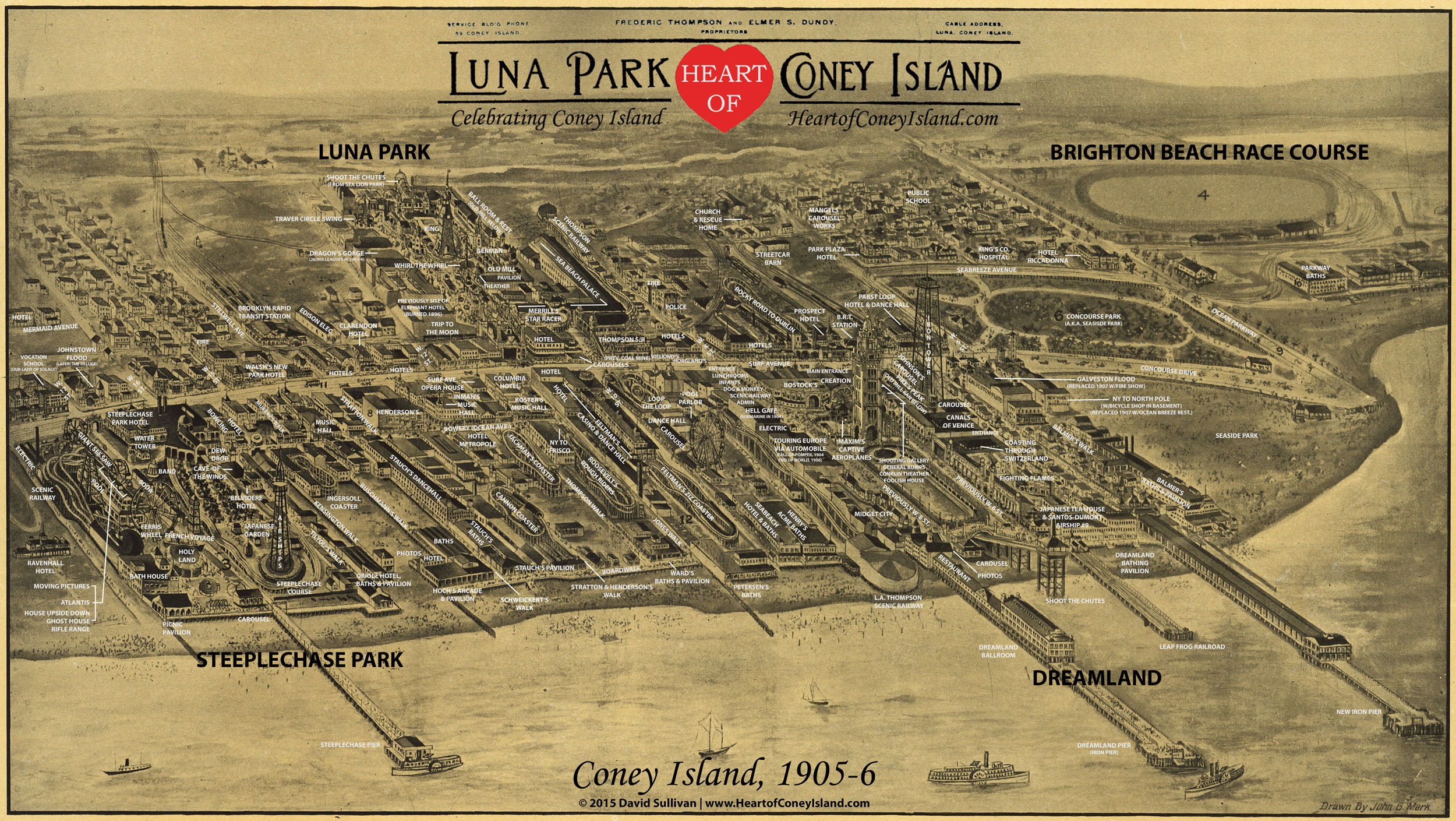
This historical map shows Coney Island at what I consider to be its peak, in 1905-1906. All the three major amusement parks are operating, Luna Park's Skip Dundy is still alive, and the Brighton Beach Race Course still is operating horse races, drawing huge crowds. Click on the map to download a higher resolution version you can magnify. Have fun seeing what Coney Island was like back then!
This map, drawn by John G. Mark, was stamped as accepted by the Map Division of the Library of Congress on April 5, 1906. The map can also be dated to between 1905 and 1906 based on the presence of various attractions, including the 'New York to North Pole' attraction (at the corner of Surf Avenue and West 5th Street; opened May 27, 1905), and the adjacent Galveston Flood building (which closed after the 1906 season and was replaced by Hagen's Fire Show for the 1907 season).
The map is, as a whole, a remarkably accurate depiction of Coney Island at the time. The map accurately portrays how individual buildings and rides looked within West Brighton, based on comparison to photographs and postcards. It appears that Mark focused his effort on West Brighton and took some liberties with the Brighton Beach area east of Ocean Parkway, on the right-hand side of the map; in that area, the buildings become much less detailed, and numerous appear to be omitted, by comparison to the Irving Underhill photo of Brighton Beach from 1905 and the hotels we know were in the area at the time (such as Proudman's Parkway Hotel, which was between the Riccadonna Hotel and the Parkway Baths, and looked different than the building shown in the map).
Note: Over 200 buildings and streets are identified in this map using a combination of fire insurance maps, photographs, postcards and amusement park advertisements. The standard I used in creating this map was that every building or ride had to be identified with certainty from primary resources, and without reference to other existing research, to avoid perpetuating any potential existing inaccuracies. This project is complex because Coney Island changed significantly every season during this period, through constant fires and bustling entrepreneurial activity. For example, someone visiting in 1902 would find major sections of the Coney Island of this 1905 map to be completely unrecognizable because of the new amusement parks, Luna Park and Dreamland. Additionally, the attractions within the amusement parks changed almost annually as well; the Luna Park of 1903 vastly different from that of 1906, and almost all of Steeplechase Park burned to the ground in July 1907 (just eighteen months after this map was made). Even Brighton Beach Race Course stopped hosting horse races after gambling on them was banned in 1908.
II. Complete Map showing West Brighton, Brighton Beach and Manhattan Beach in 1879
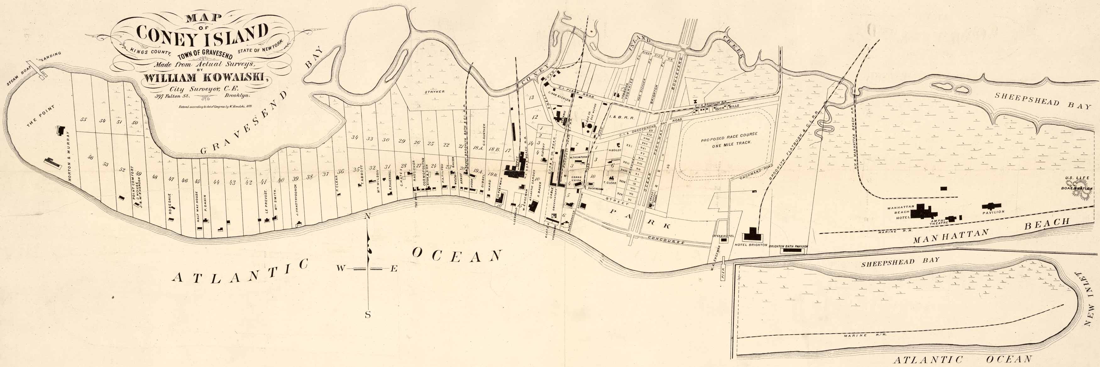
This historical map is from the Library of Congress and shows all of the venues in 1879 except for Corbin's Oriental Hotel, which was built in 1880. Click on the map to download a higher resolution image you can magnify.
III. View of Coney Island from Manhattan Beach in 1905
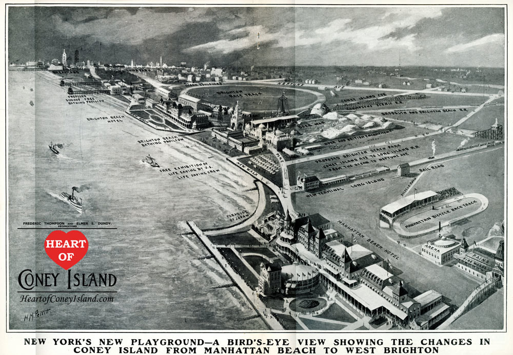
This map from the July 8, 1905, issue of Harper's Weekly, shows Coney Island during the 1905 season. The view is of Manhattan Beach, looking west towards Brighton Beach and then West Brighton in the distance at the upper left (note Luna Park and Dreamland). Click on the map for a higher resolution image.
Return to Coney Island History Homepage